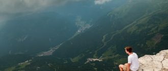
The highest road in Arizona cuts 200 miles across the middle of the state at an amazing 7,000-foot elevation. Traveling roughly from Sedona to the New Mexico border, this road hugs the edge of the Mogollon Rim. A dizzying drop from rim to the canyon floor is 2,000 feet in places.
This amazing geological phenomenon that creates a “backbone of Arizona” separates the low southern scorching desert from the higher elevation cooler, temperate rain forest. The Mogollon Rim Road (Mogollon is pronounced “muggy-own”) provides a cool, serene perch to see forever over the endless Shenandoah Valley Breach.
Today the road follows sections of an original military supply route constructed in 1872 by General George Crook. The wagon road connected Fort Whipple in Prescott to Fort Apache and Camp Verde. The military established the forts to protect early settlers from the frequent attacks of the Apache Indians, rebelling against the takeover of their land and relocation to reservations.
General Crook took command of Arizona Territory’s military in 1871. Amazingly, his original journey from Fort Apache to Fort Whipple formed the basis of the route. During construction, Crook’s men measured the wagon road’s mileage with a cloth fastened the wheel of a wagon. A certain number of the cloth’s revolutions equaled a mile. Soldiers then carved a smooth patch out of nearby trees and rocks and then burned on the mileage. Blazes generally included a letter. For example, 13 miles from Fort Verde would be marked with “V13.” Today a few trees and rocks still bear Crook’s original blaze marks. Many landmarks along the trail are named according to the mileage of the old route, such as Thirteen Mile Rock and Twentynine Mile Lake.
Approximately 15 miles from the western end and a short distance to the north of the main trail is the site of General Springs Cabin. Louis Fisher built the small wooden structure in 1914 or 1915, and it was used as a guard station for many years. The cabin sits beside springs used for water by General Crook and was reputedly the spot from which he narrowly escaped death during a surprise Apache attack. Camping around the historic cabin is prohibited but the area makes an excellent spot to stop and have a picnic lunch.
Opposite the turnoff to the cabin is the Tunnel Hiking Trailhead. Hike down to see the once ambitious project: a tunnel that was to burrow through 3,100 feet of the rock of the Mogollon Rim to connect Flagstaff to the rich mines of Globe by rail. The tunnel was to be a spur of the Atlantic & Pacific Railroad, which ran from Albuquerque through Flagstaff en route to the west coast.
The proposed 160-mile Mineral Belt Railroad was funded and construction began over incredibly rough terrain. Funding for the project soon dried up after the construction of only 40 miles of rail and blasting only 70 feet into the rock of the rim. The incomplete tunnel is located in General Springs Canyon, a low point in the rim.
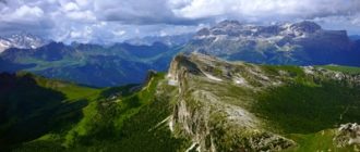
Most of the narrow graded gravel and dirt road runs through a cool ponderosa pine forest. Many places along the road run right along the rim with amazing vistas over the canyons and good angles to see rugged rim itself. Take care walking to the edge of the rim, especially in wet conditions. Some trees at the edge hold memorial plaques to those who have accidentally fallen.
The road is uneven in places, but never treacherous. Many side-paths and pull-offs locate pools and hot springs. Take care to stay on the hard pack road. Local residents estimate that vehicles roll over the road at a rate of 60 miles per hour.
If you are well prepared, the return trip to General Springs Canyon provides a sweeping panorama of the southeastern Utah desert. The trail system gently winds down through the canyon, finally descending to Rainbow Valley where the main trail meets the miniature train. General Springs itself is a small and picturesque canyon, not unlike canyons in Grand Canyon National Park.
If you are not up for a full day of adventures, the East Entrance to the Canyon offers just enough change of scenery to hold your interest. The wintry temperatures have kept visitors to the Entrance to replace some of their seasonal clothing.
If you are ready for more adventure, the Panoramic Tour remains one of the most beautiful and amazing sights around the Canyon. Instead of a fixed itinerary like the others, the portable tour allows visitors to go when they want, stopping for a place to sleep and a fresh meal along the way.
So far, the trip offers several fantastic natural settings and scenic routes, but the cold weather and sparse restroom supply make return trips a deterrent.


